Iceland has stunning geographical features including mountains, glaciers, waterfalls, volcanoes and a pristine environment. The Nordic island nation of Iceland occupies an area of 40,000 square miles in the North Atlantic Ocean on the edge of the arctic circle. The island owes its existence to a large volcanic fissure in the Mid-Atlantic Ridge, where the Eurasian and American tectonic plates meet.
Iceland is largely an arctic desert punctuated by mountains, glaciers, geysers, hot springs, volcanoes, and waterfalls.
Most of the vegetation and agricultural areas are in the lowlands close to the coastline.
Interesting: Heat and electricity prices in Iceland are generally quite low because of the use of geothermal power, meaning that the country's reliance on fossil fuels to heat its homes is minimal. However, only 30% of the energy produced in Iceland is geothermal; around 70% is hydroelectric. Geothermal heating, on the other hand, produces just over 80% of the country's heat and hot water requirements.
Below are a few images of my trip aboard the National Geographic Resolution as we circumnavigated the country.
Our travel path with landing spots marked.
Idyllic setting on Flatey Island. It is summer in Iceland. Nice to have sun however wind and rain seemed more typical. Temperature between 40-50F generally while visiting. Each landing we were advised to wear multiple layers with a waterproof exterior. It proved prescient!
Located in North Iceland between Akureyri and Lake Myvatn, this picturesque Godafoss or ‘Waterfall of the Gods’ is one of the most impressive in the country. Ice-blue glacial water flows over an elegant semi-circular arc. It creates blue-green swirling patterns in the water below among the surrounding lava. The white Mountain Avens - Iceland’s National Flower in the foreground.
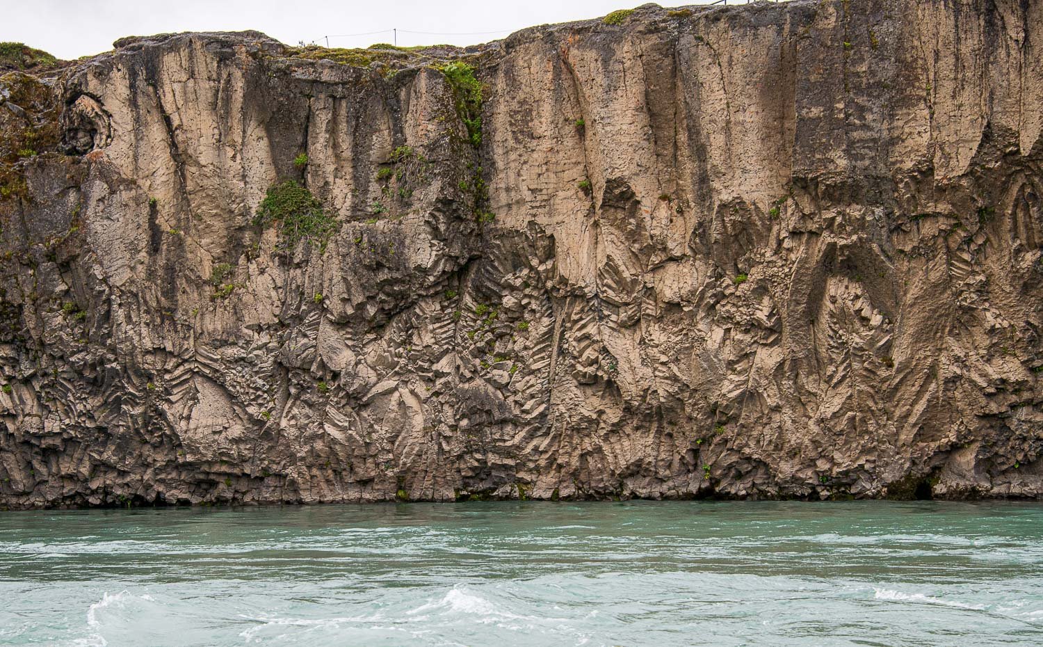
Interesting rock sculpture down-river from the falls.
Nicknamed the "Capital of North Iceland", Akureyri is an important port and fishing centre.
Deep in the remote Westfjords of Iceland, you will find the breathtakingly beautiful Dynjandi waterfall. Dynjandi, or Fjallfoss as it is often called, cascades some 325 feet. On top, it is 98 feet wide and widens up to 190 feet at the bottom.
There are 6 other waterfalls below Dynjandi, which one passes on the way up to the biggest waterfall. It is quite a scenic route with an elevation of some 650 feet up to the biggest waterfall.
The Arctic Buttercup flowers add a nice foreground.
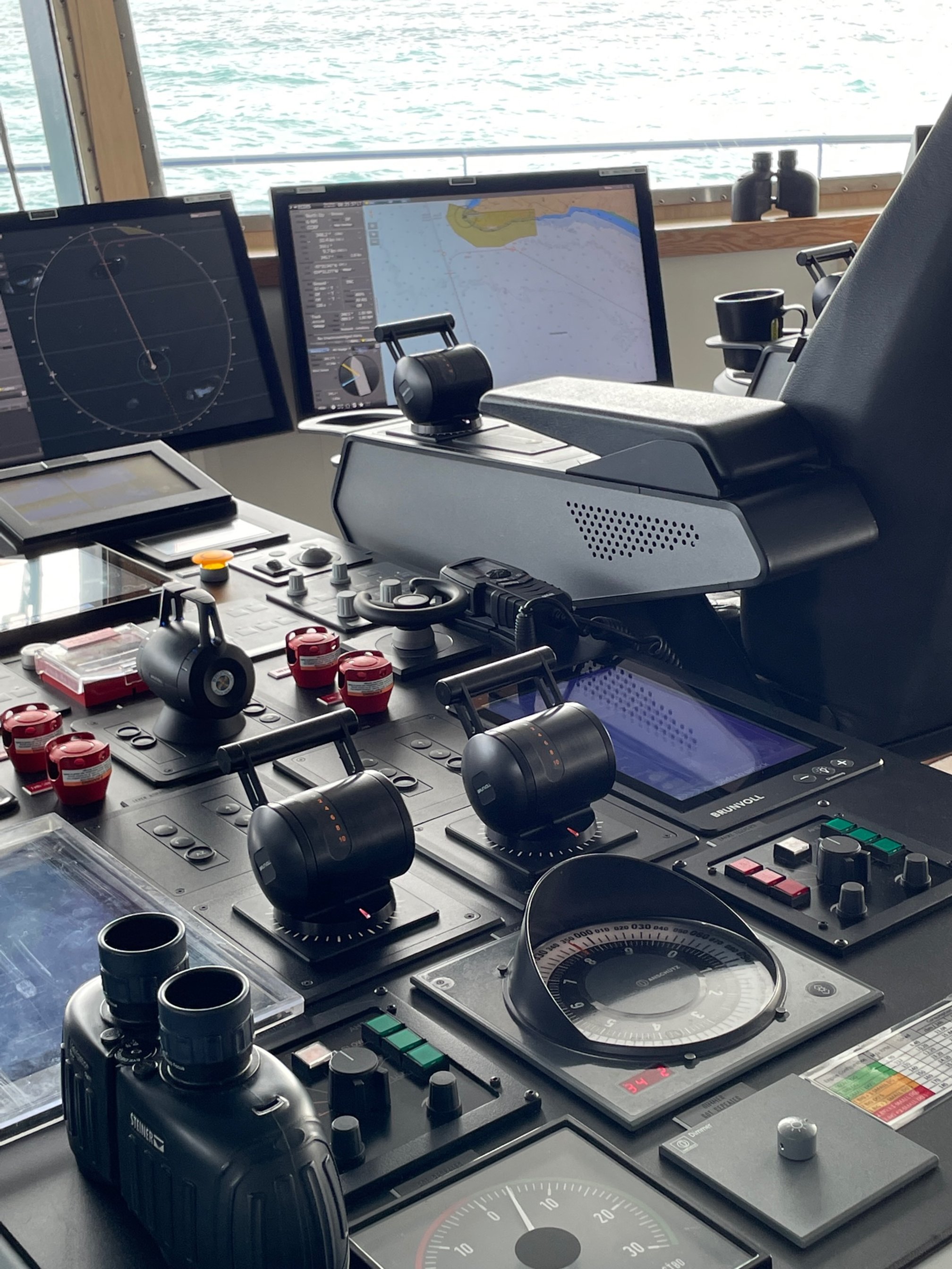
Speaking of buttercups…….The ship is quite sophisticated - anchors not used (though present for safety) the GPS systems linked to the engines hold a specific spot automatically. Wow!
The bridge.
Wet landings are a natural part of getting ashore ahead of exploring/hiking. Zodiacs to-ing and fro-ing an almost daily event. Our ship is a new Purpose-built for polar navigation. The National Geographic Resolution is an ice-class Polar Class 5 (PC5) vessel. A patented X-bow® with powerful wave-slicing action provides an extremely smooth ride in even adverse conditions, and also reduces spray on deck for superior observation.
I can tell you in rough seas despite it’s characteristics you walk with one-hand on the wall ! Sleeping can be a challenge also. It is however a beautiful ship with all the expected amenities.
Zodiacs make it easy to see the shore birds and other fauna up close!
Skalanes, a unique private nature reserve located on a once-abandoned farmstead, showcases the incredible flora, fauna and ecosystems of the region.
The Lupine is a non-native flower brought to Iceland from Alaska to control erosion. Icelanders have a love-hate relationship with it.
What can I say about this image. A beautiful hike.
This is classic Iceland. Built from lava flow and tectonic machinations. Covered 11% by glaciers.
The Vatnajökull ice cap has dozens of valley glaciers that empty into different rivers. One of the most important is Breiðamerkurjökull, which stretches into the Jökulsárlón lagoon. This glacial lake is teeming with icebergs large and small that have broken off the glacier.
By the way, unless you are a native, good luck pronouncing the names…..
The most-loved bird of Iceland is the Puffin. They are a sea bird - only coming to land to raise their young. They nest in burrows and here they are gathering fish to feed the newborns.
Apparently they are very smart! Here is one studying undersea life! Each day when I returned to the cabin the housekeeper had the puffin doing different things. It was fun to anticipate what was next!
Hope you enjoyed my images on this trip! Thanks for looking!


